Skip to content

Location Intelligence Pulse

Satellite geo-analytics reveal how places and their surrounding conditions are changing. Replacing fragmented, outdated data with objective insight we guide site selection, investment and expansion decisions.

Renewable Energy Image

Support location-based decision making across sectors with site and network data geo-contextual insights.

Discover how infrastructure teams can bring terrain, climate, accessibility and feasibility into one view — comparing sites and avoiding costly location decisions.

Trusted by

  • EUSPA_Logo
  • telefonica-logo-0-1
  • loreal
  • Repsol_logo.svg
  • ESA_logo.svg
  • TECH-BARCELONA-MARCA-02-4c3ad4bd
  • Hispasat_logo_2022.svg
  • idrica
  • logo-aenor-web-med

Smarter site selection

Teams making location-based decisions such as where to site assets, where to invest, and how to manage exposure across a portfolio, need to understand the full territorial context around each site, not just its technical potential.

Our smarter site selection tool helps you identify the most viable locations for new pipelines by combining terrain, climate and infrastructure potential into a single suitability map.
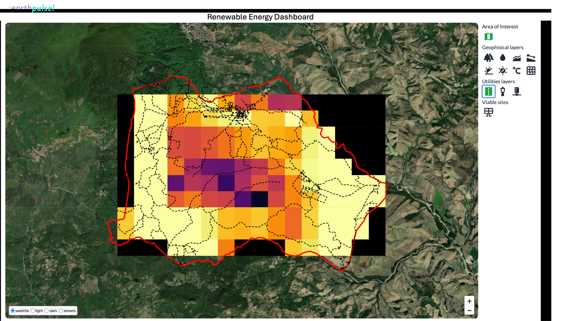
Renewable Energy Dashboard

Investment de-risking & secure financing

Location intelligence for new infrastructure is key for assessing physical constraints, climate and environmental exposure, accessibility, infrastructure proximity, and development feasibility together.

This solution lets you assess physical and operational risks early, helping investors avoid unsuitable areas before committing resources.

We provide clear, map-based evidence of site viability and risk reduction to support bankability, due diligence and investment decisions.

21

How It Works

What are the benefits of our solution:

 Dozens or hundreds of sites screened and ranked consistently, in a fraction of the time 

10+ years of historical satellite data available for baseline assessment 

 Up to 90% reduction in the time required to identify and screen potential solar project locations 


Building pulses

We build our solutions with your needs at the centre. 
  • compare_arrows
    compare_arrows

    Operationally proven

    Our Operational solutions are built on validated models and automated workflows designed for real-world challenges. We combine scientific rigour with production-grade engineering to deliver reliable intelligence where delays and errors are not an option.

  • all_inclusive
    all_inclusive

    Integrated into your operations

    Our solutions plug directly into your existing systems and workflows — API-first, automation-ready, and deployable on your terms. You maintain full control over your data and models while gaining intelligence that works inside your daily operations.

  • check
    check

    Built for action at scale

    We design tools that help you set scale timely intervention across sites, regions, and countries. By turning complex geospatial data into structured, operational insight, our Pulses scale just in hours, helping teams act earlier, allocate resources smarter, and manage risk consistently wherever they operate.

Get in touch today

Our solutions are designed to integrate seamlessly into your existing workflows, delivering actionable intelligence when you need it most. Whether you're responding to immediate operational challenges, planning strategic initiatives, or proving compliance, we have a solution tailored to your industry and business needs.

What happens next?

  • Schedule a consultation with our industry specialists

  • Explore solutions tailored to your specific challenges

  • Request a demonstration with your own data

  • Receive a customised implementation plan