Water Quality Pulse
From sparse sampling points to continuous, network-wide intelligence — satellite geo-analytics help utilities detect emerging water quality risks earlier and prioritise response.
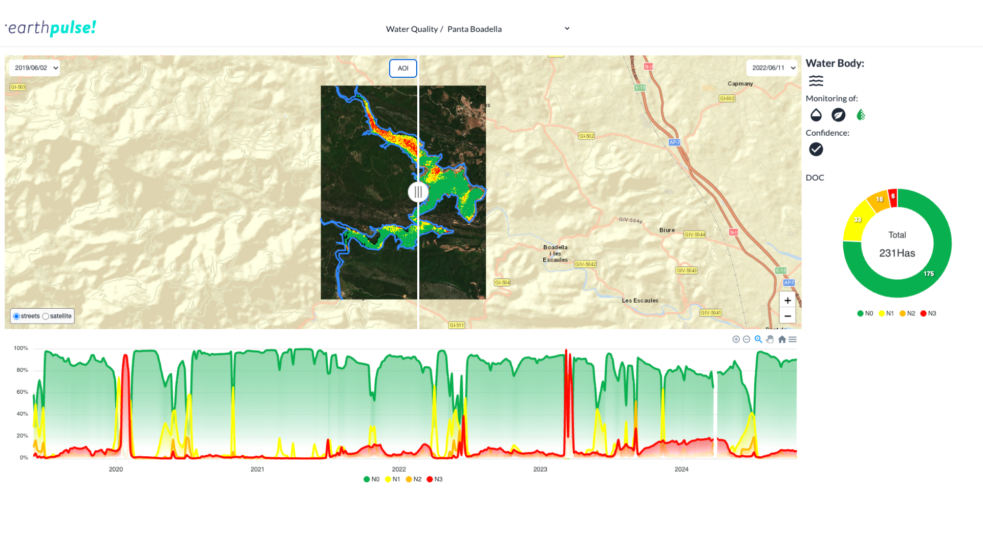
Track water quality, algae bloom, turbidity and other indicators over time.
Discover how water utilities can continuously monitor water quality, prioritise field investigations, and stay ahead of contamination and compliance risk.
Trusted by
Drinking water treatment support
Water quality can change rapidly due to droughts, extreme rainfall, temperature shifts, and pollution loads — affecting drinking water treatment.
The Water Quality Pulse help water and utilities managers anticipate quality changes and adjust chemical treatment needs more efficiently.
Wastewater process monitoring
Fluctuations in wastewater processes create operational uncertainty, disrupting processes and increasing risk for assets that depend on stable, predictable water conditions.
We help wastewater operators and renewable energy companies monitor water quality in reservoirs, rivers, treatment plants and critical water assets to track quality changes across treatment cycles to support operational control and reporting.

Algae and turbine risk monitoring
Climate variability and resource constraints make consistent water quality monitoring increasingly difficult.
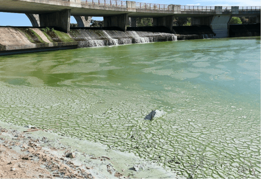
This solution lets you detect chlorophyll and algal bloom indicators that may affect turbines or other water-dependent infrastructure.
What are the benefits of our solution:
|
Full-coverage monitoring: entire lakes, reservoirs, or coastlines, no physical sampling needed. |
Long-term trend detection: automatic tracking over time, with years of historical data to surface patterns. |
Advancing water monitoring with satellite intelligence
To strengthen reservoir monitoring and support data-driven decision-making, Aigües de Manresa partnered with Earthpulse to integrate satellite-based water quality analytics into its operations.
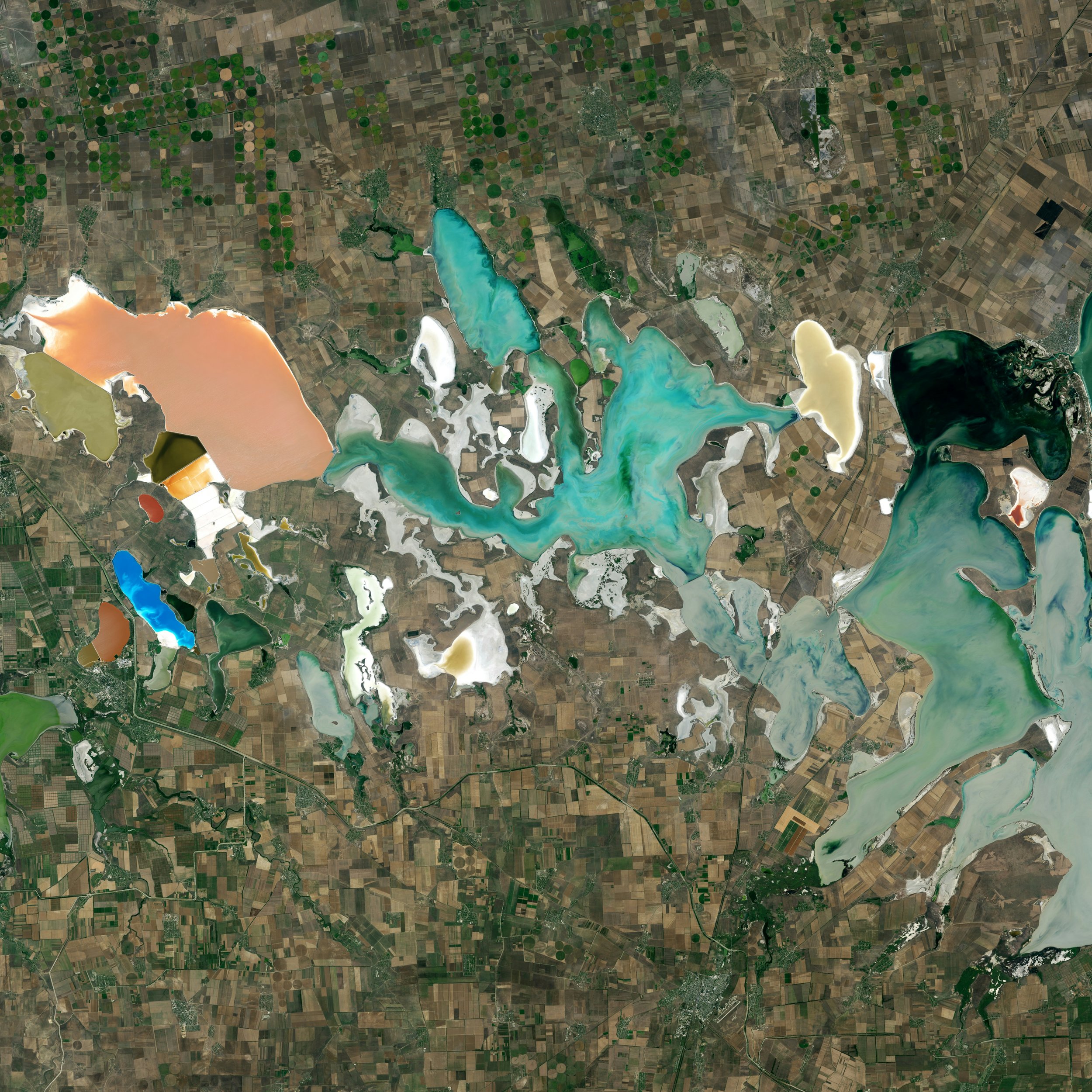
Earthpulse deployed a satellite-based water monitoring system using high-resolution Sentinel-2 imagery from the European Union’s Copernicus programme.
Key outcome
This solution lets you prioritise assets and regions for resilience planning and investment.
Proactive risk management
Identify vulnerable assets before climate impacts escalate by combining hazard modelling with exposure analysis of infrastructure, supply chains, land, and communities.
Rapid impact assessment
This Pulse enables early prioritisation, targeted adaptation measures, and smarter long-term risk management. Quantify damage within hours of an event, not days.
Strategic adaptation planning
Turn climate exposure data into forward-looking investment intelligence. Compare scenarios, prioritise infrastructure upgrades, optimise asset allocation, and align resilience spending with measurable risk reduction across regions and portfolios.
How It Works
Select the assets
Once you select the area or asset, we customise the solution for you. At this stage, we collect satellite data (like Copernicus), and integrate additional relevant data sources, such as geospatial, economic, weather, or proprietary data.
Data processing via SPAI
SPAI supports data collection and processing by using automated workflows and in-house models, with human-led quality checks to ensure consistent results across sites and time.
Pulses deliver the insights
The processed data is translated into structured intelligence: indicators, trends, actionable alerts that move you beyond static maps. At this stage you receive precise indicators that pinpoint exactly where to focus your attention to prevent outages or damage.
You may also be interested in our other solutions...
Find out what operational risks you could address with our Pulses.
Building pulses
We build our solutions with your needs at the centre.
-
compare_arrowscompare_arrows
Operationally proven
Our Operational solutions are built on validated models and automated workflows designed for real-world challenges. We combine scientific rigour with production-grade engineering to deliver reliable intelligence where delays and errors are not an option.
-
all_inclusiveall_inclusive
Integrated into your operations
Our solutions plug directly into your existing systems and workflows — API-first, automation-ready, and deployable on your terms. You maintain full control over your data and models while gaining intelligence that works inside your daily operations.
-
checkcheck
Built for action at scale
We design tools that help you set scale timely intervention across sites, regions, and countries. By turning complex geospatial data into structured, operational insight, our Pulses scale just in hours, helping teams act earlier, allocate resources smarter, and manage risk consistently wherever they operate.
Get in touch today
Our solutions are designed to integrate seamlessly into your existing workflows, delivering actionable intelligence when you need it most. Whether you're responding to immediate operational challenges, planning strategic initiatives, or proving compliance, we have a solution tailored to your industry and business needs.
What happens next?
-
Schedule a consultation with our industry specialists
-
Explore solutions tailored to your specific challenges
-
Request a demonstration with your own data
-
Receive a customised implementation plan